Sun City Summerlin Detail Map
Las Vegas Age Restricted Communities
Aerial Map Detail – Sun City Summerlin

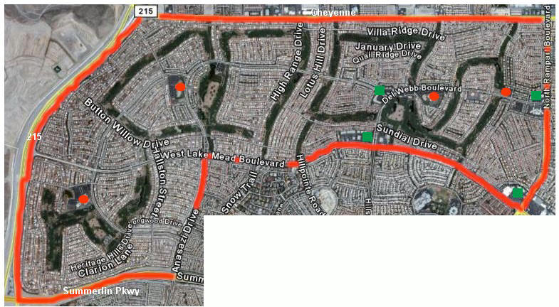
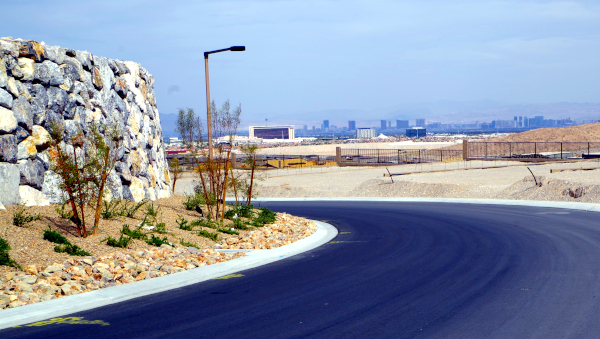
This aerial view map represents the entire community of Sun City Summerlin bordered in red. The community built, over the years, from right to left (east to west) as you are viewing this map. It expanded past its originally anticipated borders when Del Webb purchased a additional piece of land. This extension of the community, south of W. Lake Mead Blvd., is represented on the map in the lower left. The community is bordered by Summerlin on the west and south and by the planned community of Desert Shores on the east. Most of the construction on the north side, north of Cheyenne, was done in the mid 1990’s and while not in a planned community, is residential. Lake Mead and Cheyenne provide the main corridors for retail, commercial services. The dark areas reflect the golf courses. One bit of additional information. Pulte/Del Webb in 2007 purchased from Summerlin land just to the west of the 215 from Sun City Summerlin. They paid in the area of $900,000 and acre for this land. Their plan are as I understand it is to build something other than age restricted.
The red icons above represent the locations of the 4 community centers at Sun City Summerlin.
The green icons above represent the locations of commercial services either inside the community or on the perimeter. These include all manner of businesses including, but not limited to, restaurants, post office, banks, drug store, and medical offices. This is a golf cart friendly community and all homes north of Lake Mead can access any of these centers by walking or by golf cart without, in essence, leaving the community. This would even apply to the large Smith Center (see lower right). There is a back gated entrance to this center from the community.


